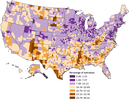
Standardized choropleth maps are maps which compare different geographic differences much like their unstandardized relatives but they include the figures needed to accurately make an informed comparison of the distances between the variables. This map measures the levels of poverty throughout the country. One can get a better view of the how much of a difference exist between the different regions by the representations of the colors.
http://www.cdc.gov/pcd/issues/2007/oct/07_0091.htm
No comments:
Post a Comment