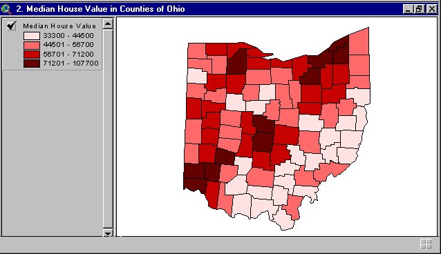
A Choropleth map is another thematic map measuring different levels of aerial units. These figures can be nominal, univariate, bivariate, classed, unclassed, standard, or unstandard. Here is a classed choropleth map representing home values in my home state of Ohio.
http://proceedings.esri.com/library/userconf/proc99/proceed/papers/pap171/p171.htm
No comments:
Post a Comment