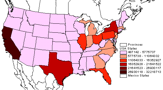
Classed choropleth maps shade the comparative areas but, unlike their unclassed versions, numerical figures are included to better compare the data and add legitimacy to the data. The population densities of the country are mapped in this Classed choropleth map.
http://hosting.soonet.ca/eliris/remotesensing/bl130lec7.html
No comments:
Post a Comment